
Mississippi's gold dust
Can sediment save Louisiana's disappearing coastline?
A hulking old engineering boat moves slowly up the mile-wide Mississippi River. The Dredge Jadwin operates like a gigantic vacuum cleaner, sucking up sediment from the riverbed and spewing it out to the side through a long pipe. “For us, sediment it’s basically a problem,” says Randy Stockton, master of the Jadwin, built in 1933. “It clogs up the shipping channel. It silts in the river ports. The more of it there is, the harder we work to move it. But down on the coast this stuff is like gold dust.”
These tiny particles of sand and silt, some of which have washed all the way down the river from North Dakota and Minnesota, are at the center of a heated debate in south Louisiana. According to most scientists and environmentalists, sediment from the Mississippi is the best hope of saving Louisiana’s disappearing coast. They support projects, now in the planning stages, that will divert river water into the eroding coastal marshes, in the hope that sediment will settle, accumulate and form land.
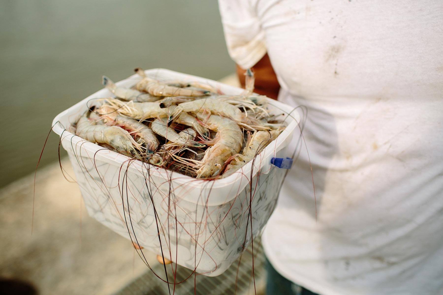
The opponents of these proposed diversion projects, many of whom work in Louisiana’s $2.6 billion seafood industry, are also concerned about coastal land loss. But freshwater from the Mississippi, they say, will destroy the shrimp, oysters and commercial fish species that live in the brackish water of the marshland. Instead, they are calling for dredges like the Jadwin to suck up existing underwater sediment and use it to build land. “Dredge don’t divert” is their rallying cry, plastered on bumpers, placards and T-shirts. Indeed, dredging is a proven, if expensive, method that is already taking place in many areas.
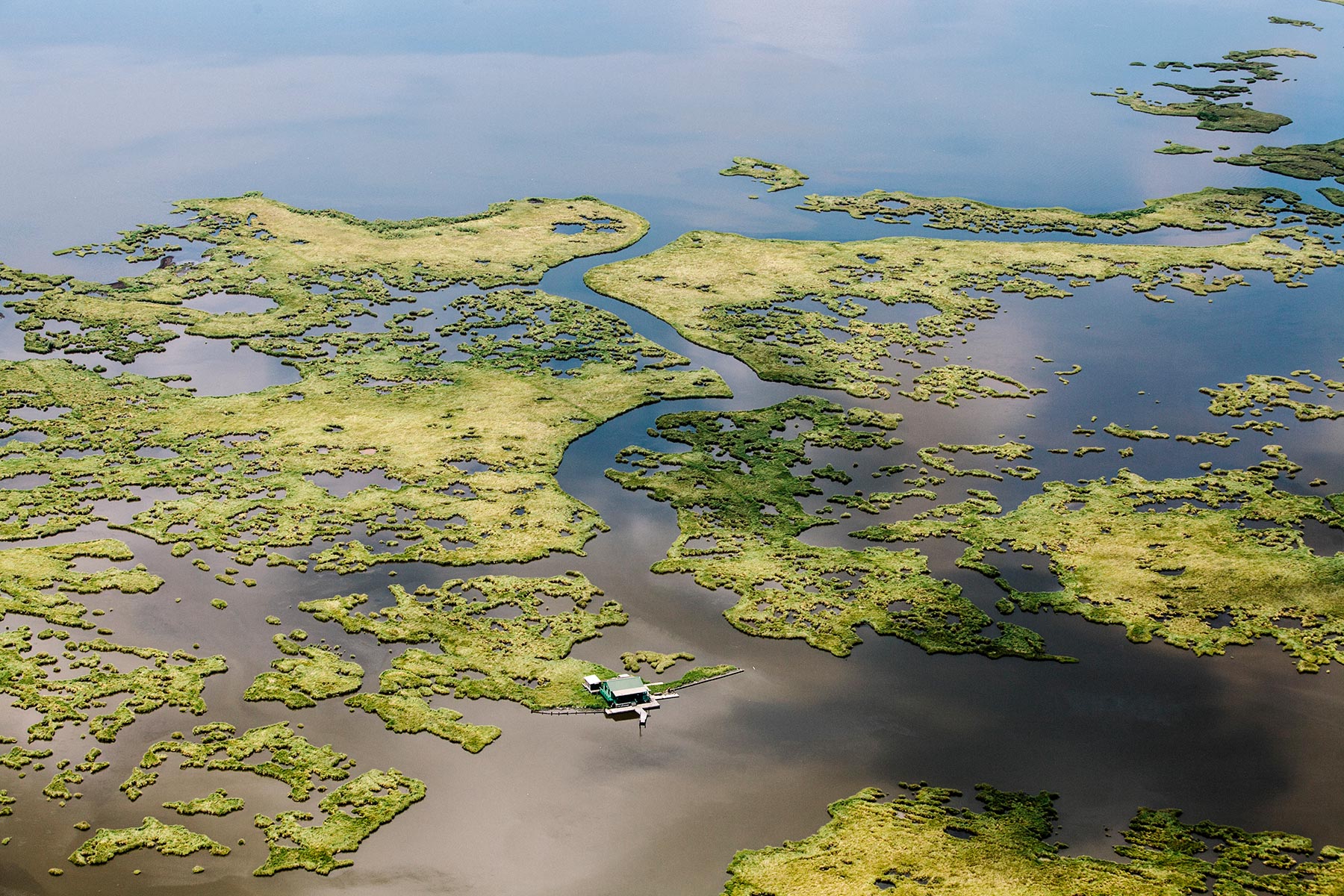
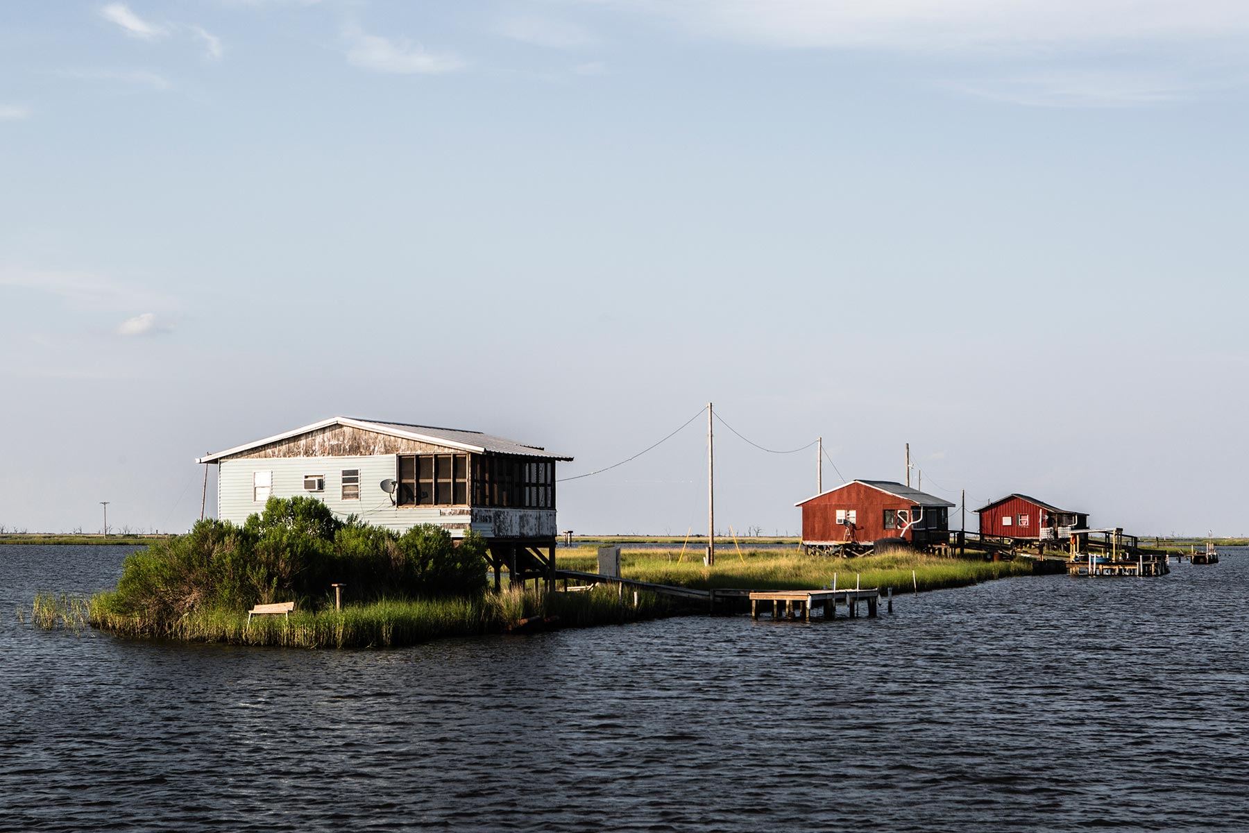
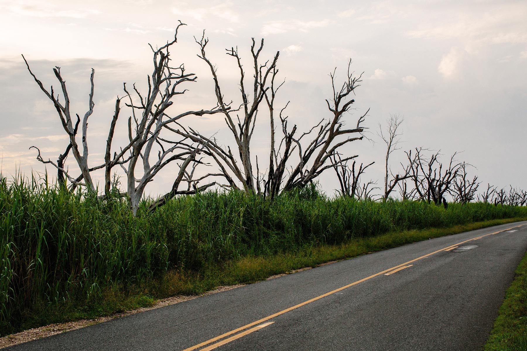
Nowhere else on earth is river sediment so politicized. But, then, nowhere else has lost so much land — a football field’s worth every hour, a Manhattan every 18 months. This is a slow-motion catastrophe, quiet and relentless. When you drive through flat, marshy Terrebonne Parish, on the front lines of America’s worst environmental crisis, you see only two obvious signs that something is wrong: groves of skeletal trees killed by the encroaching salt water from the Gulf of Mexico and the many homes and fishing cabins jacked up on 14- and 17-foot stilts.
It takes someone who grew up here, like Jonathan Foret, executive director of the South Louisiana Wetlands Discovery Center in the town of Houma, to point out what has been lost: “There are so many places where people used to hunt and camp and graze cattle that have all gone to open water now. The land is sinking and washing away into the ocean. Now we’re starting to lose whole communities.”
Foret is a former Peace Corps member who worked in Tonga and flood-prone Bangladesh before returning home to help his own flood-threatened community in south Terrebonne Parish. “It breaks their heart to leave,” he continues, “but they’re tired of being resilient. A lot of us are. I’ve come to hate that word.”

For thousands of years, the Mississippi river swung back and forth across a 200-mile stretch of the Louisiana coast, depositing hundreds of millions of tons of sediment every year when it flooded over its banks. Plants and trees knitted the sand and silt into a coastal wetland plain of 7,500 square miles. Foret’s Cajun ancestors, and the Native American groups that fished, trapped and spoke French alongside them, learned to live with the seasonal river floods and the hurricanes whipping in great surges of seawater from the Gulf of Mexico. “They knew where the high ground was,” says Foret. “They knew when to evacuate. They knew where to plant crops when the water subsided.”
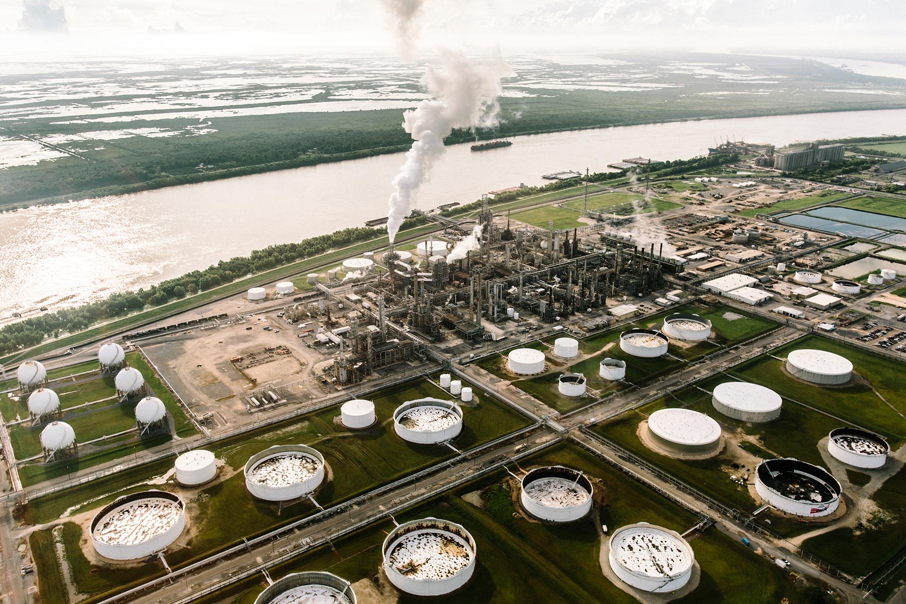
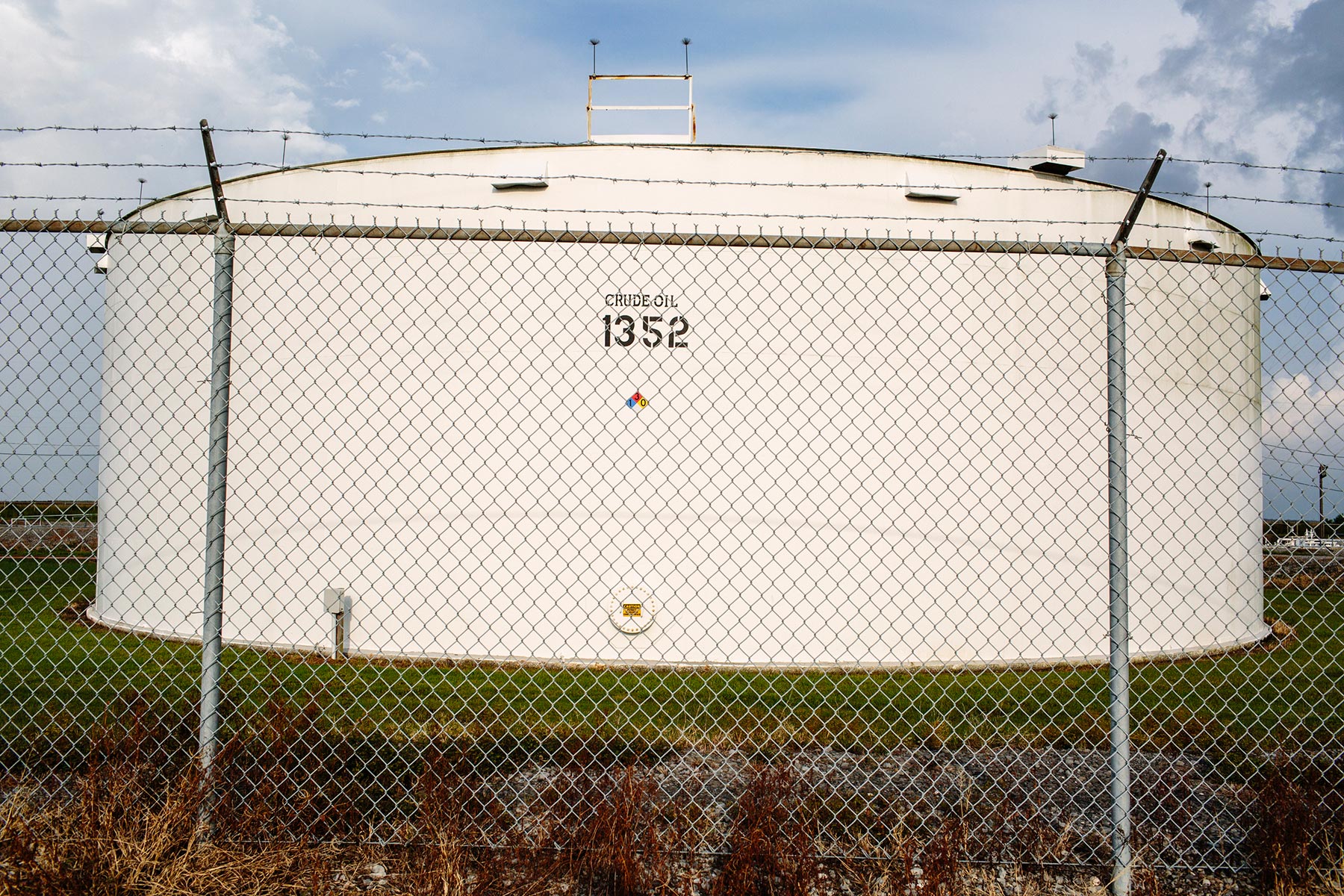
Then came the Great Flood of 1927. Massively swollen from torrential rains, the Mississippi overran its banks and levees, destroyed 130,000 homes in six states and displaced 700,000 people. The federal government vowed never again, and the U.S. Army Corps of Engineers began walling in the river with bigger, stronger levees and taming it further with spillways, dikes and other measures. Over the decades, the Corps transformed the big unruly river into a shipping channel that now transports $95 billion in goods a year. South Louisiana is the unfortunate casualty of this engineering triumph, because the river’s sediment goes straight out between levees into the Gulf of Mexico and off the continental shelf.
Starved of its annual sediment replenishment, but subjected to the same wave erosion, the land on the coast is compacting, sinking, melting away into the ocean. Marshes are dissolving as salt water creeping inland poisons the roots of plants and trees. One thousand nine hundred square miles are gone already, and from the air, Louisiana’s southern “boot,” still featured as solid ground on the state maps and highway signs, looks more like a half-eaten jellyfish.
If invading armies or terrorists were sinking a football field of American soil into the ocean every hour, the nation would stop them at any cost, as many south Louisianans have pointed out. But so far the federal government has shown little inclination to get involved and no urgency. Even Louisiana politicians have been reluctant to tackle the slowly mounting crisis, partly out of loyalty to the state’s billion-dollar oil and gas industry.
“The oil and gas companies have made things much worse by cutting thousands of miles of canals through our wetlands, but oil and gas are our biggest employers, so we don’t like to criticize them,” says Foret. “Plus sea levels are rising because of climate change. Plus we have hurricanes, which shear away marshlands. It’s a very tough situation, and I’m not seeing the political will to fix it.”

The state of Louisiana has a so-called coastal master plan, approved by the legislature in 2007 and revised in 2012. In 50 years, for $50 billion, it promises to save and reclaim a sustainable area of the coastal plain. The plan includes new seawalls and levees, dredging projects to build new land and, most controversially, 10 large-scale sediment diversion projects. At first, the idea was to cut breaches in the Mississippi’s levees and let the muddy river water flow out into the marshes, but computer modeling now suggests a more sophisticated approach will be necessary.
“Open bays need heavier sands, and marshlands need finer silts,” says Erin Plitsch, a coastal resources scientist with Louisiana’s Coastal Protection and Restoration Authority. “We have to get the right type of sediment to the right place. We have to regulate flows to control the salinity levels, and mimic the natural ebb and flow of salt water and freshwater in the marshes at different times of year.”
Diversion projects on this scale are an untested technology, but the computer models look encouraging, and so does the real-world example of the Atchafalaya River. It branches off the Mississippi near Simmesport, Louisiana, and receives 30 percent of the Mississippi’s water and sediment. After flowing roughly south for 140 miles, the Atchafalaya dumps most of this sediment at Wax Lake and Atchafalaya Bay on the coast. In these two locations combined, a square mile of land is forming every year — and it doesn’t cost a dime.


All four of Louisiana’s gubernatorial candidates support sediment diversions and the coastal master plan. So does John Barry, the influential New Orleans author, historian, land loss expert and activist, although he thinks its chances of success are very slim.
“Firstly, is there enough sediment in the river?” he asks. “The Mississippi used to carry 400 million tons a year. Now it’s carrying 200 million tons, and that includes the Atchafalaya.” Reservoirs and dams on the Missouri and other tributaries trap about half of that missing sediment. The rest never makes it into the river, says Barry, mainly because for hundreds of miles the Corps has armored the riverbanks against erosion with gigantic concrete-and-steel mats.
“Nonetheless, I would tentatively say that we do have enough sediment to build a sustainable future for southern Louisiana, if the other hurdles can be overcome,” he says. The biggest hurdle by far is funding. The coastal master plan makes no promises to fund the $50 billion, and no one seriously believes that will be enough anyway, says Barry. A study by the Tulane Institute on Water Resources Law & Policy puts the real figure between $94 and $113 billion, but “we have only a fraction of that money in place.”
The oil and gas industry is responsible for 36 percent of the land loss, by its own admission, and Barry has launched a controversial lawsuit requiring 97 different corporations to pay for the damages, to the tune of $18 billion or more. It was filed in July 2013 by a levee board called the Southeast Louisiana Flood Protection Authority - East. Barry sat on the board at the time. The suit incurred the wrath of Bobby Jindal, the Louisiana governor and Republican presidential candidate, who has accepted more than $1 million in campaign contributions from the oil and gas industry. Not only did Jindal decline to renew Barry’s position, he also announced that no one who supported the lawsuit would be allowed to serve on the levee board.
“If oil and gas pays its fair share, and if conservative Louisiana politicians raise taxes so the state pays its fair share, then maybe the federal government would consider funding the rest of it,” says Barry. “But American taxpayers are not going to send tens of billions of dollars down here on a scheme that has no guarantee of success if we’re not willing to do our part.”
There are also local political challenges. There’s not enough sediment — or money — to save all of southern Louisiana, and a team of experts is now recommending moving the mouth of the Mississippi further north and abandoning everything in the far southeast. “How do you tell someone that their community is going to be left to dissolve into the ocean?” asks Barry.
Slideshow: Life aboard the Dredge Jadwin
-
 Floating panels connect the pump house to the main vessel on the Dredge Jadwin. (Click to enlarge images)
 -
A video diagram of Mississippi River traffic inside the pilot house at the top of the Jadwin helps dredge equipment operators monitor their progress. (Click to enlarge images)
-
When lowered to the bottom of the river, the suction head of the dredge, above, sucks up sediment like a vacuum cleaner. (Click to enlarge images)
-
Sediment sprays out from the end of the dredge pipe in the middle of the Mississippi River. (Click to enlarge images)
-
Robert Mace, 55, has worked on the Jadwin for 25 years. He currently operates dredge equipment from the pilot house overlooking the front of the vessel. (Click to enlarge images)
-
The gigantic Dredge Jadwin is 274 feet long. It has been in service since 1933. (Click to enlarge images)
-
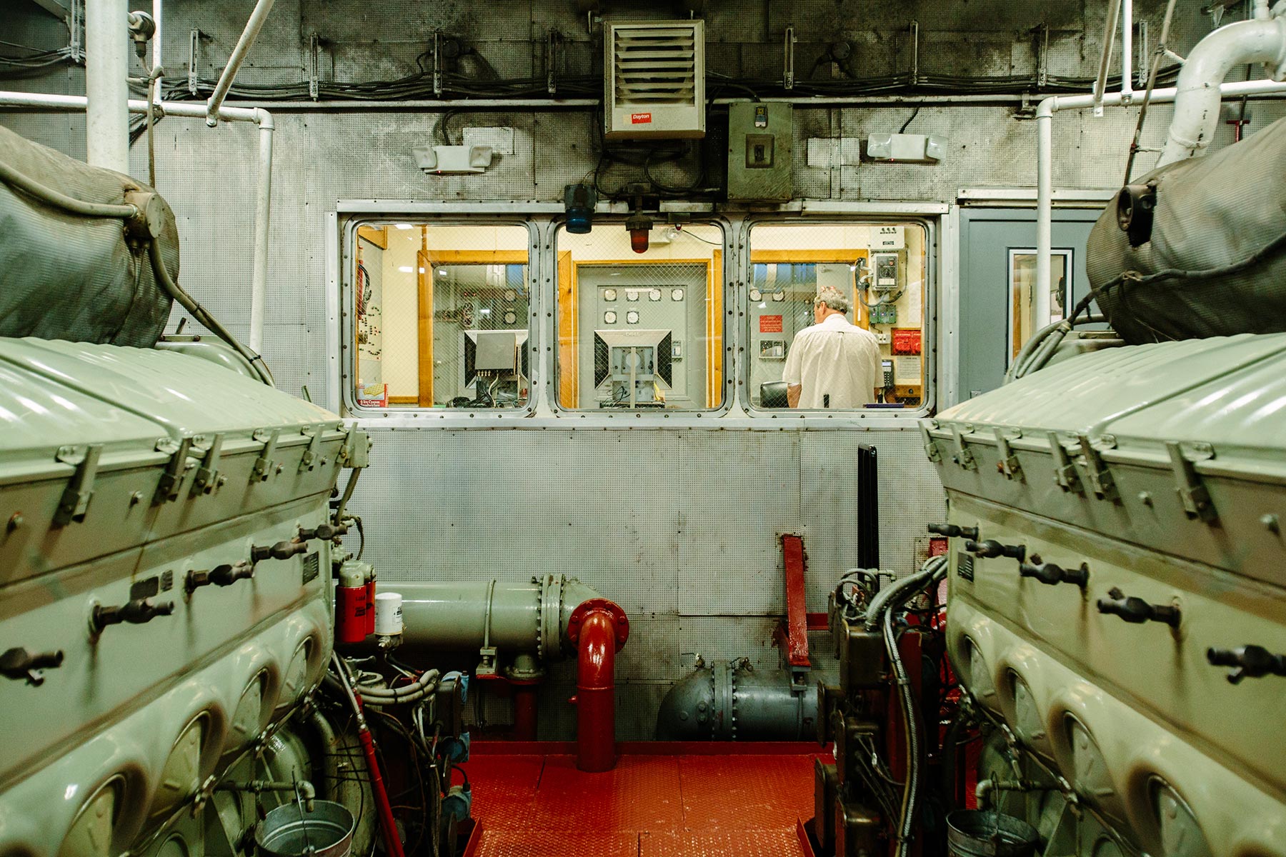
The engine control room in the Jadwin. (Click to enlarge images)
-
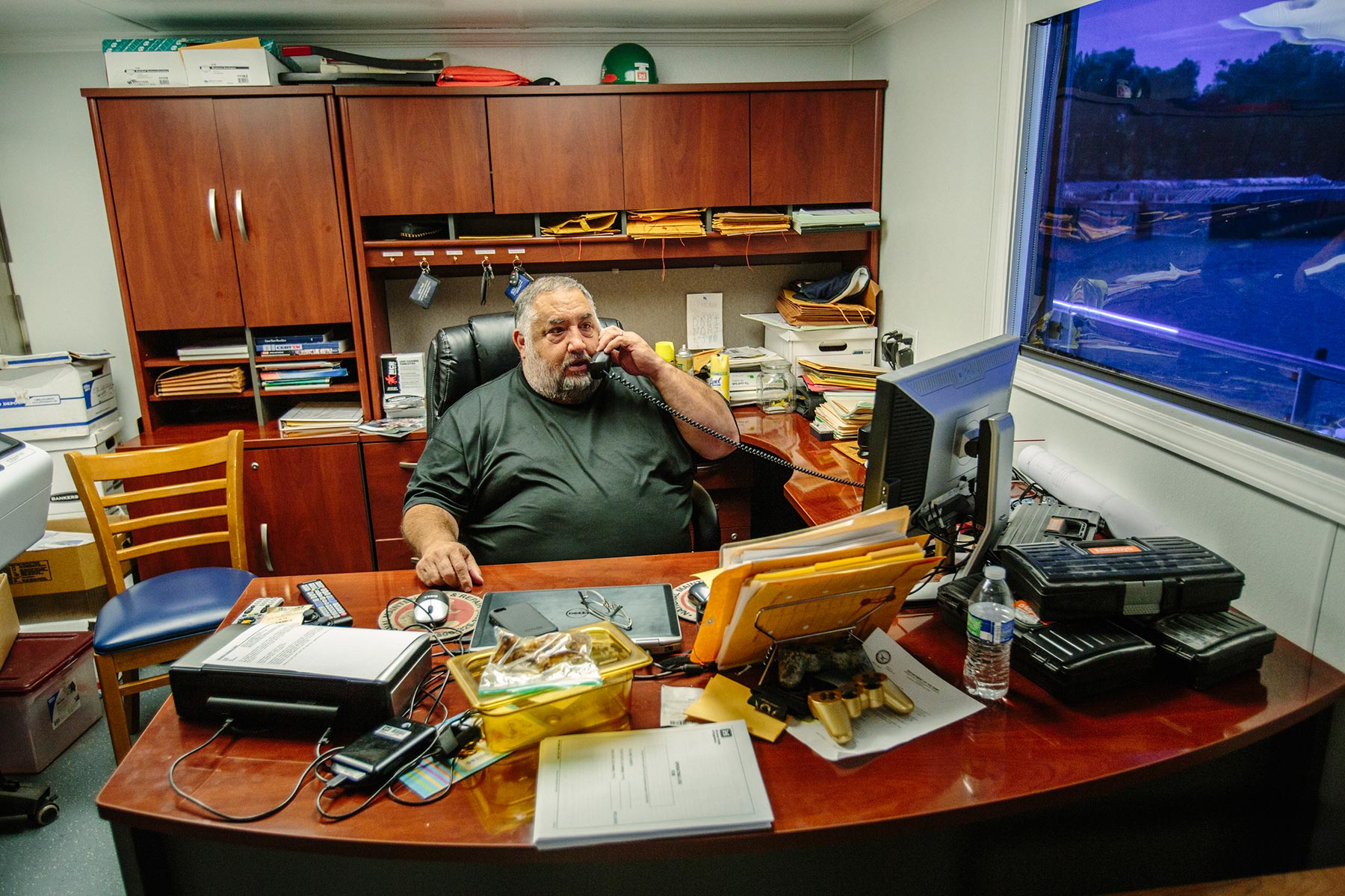
Perry Huskey, chief engineer of the Jadwin, works at his desk on the boat. (Click to enlarge images)
-
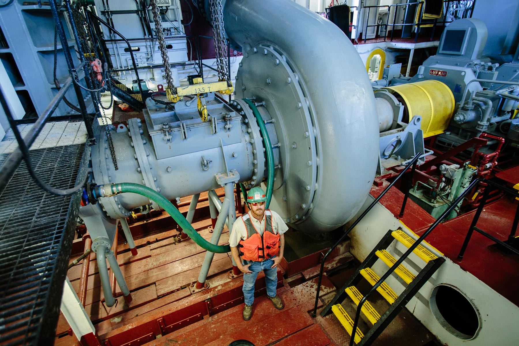
Charles F. Ashley Jr. stands in the pump room at the bottom of the Dredge Jadwin, Sept. 14, 2015. The Jadwin moves sediment from designated shipping channels into the middle of the Mississippi River, where the natural current pushes it southward, toward the Gulf of Mexico. (Click to enlarge images)


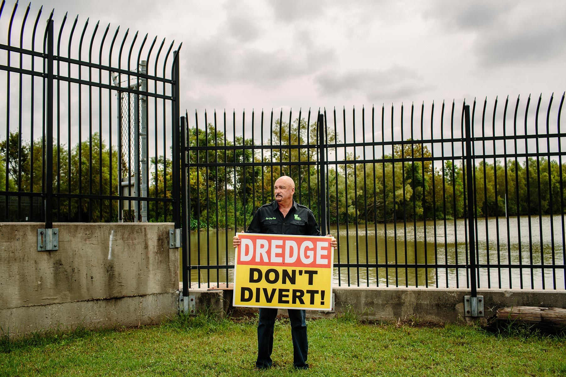
Another obstacle is the seafood industry, which is vigorously fighting the proposed diversion projects, under the leadership of a sport-fishing captain named George Ricks. He has organized more than a thousand fishermen, shrimpers, oystermen and local residents into an anti-diversion movement called Save Louisiana Coalition. They want all diversion projects canceled and land to be rebuilt only with dredged sediment. They have disrupted town meetings, hounded lawmakers and held public protests.
“For starters, this river water is full of pesticides and agricultural runoff,” says Ricks, standing on a bridge overlooking the Caernarvon diversion project. He is a tough-looking character who speaks in the Brooklyn-esque accent of St. Bernard Parish, just south of New Orleans, and he glowers fiercely at the muddy Mississippi water flowing under the bridge into the marshes.
“When they opened up this diversion, that freshwater nearly wiped out the brown shrimp completely,” he says. “It was pouring in here like poison, 8,000 cubic feet per second, with no regard for salinity levels.” Ricks and his supporters also dispute the idea that diversions are effective at building land. “The freshwater builds mostly vegetation, floating or shallow-rooted, not solid ground,” he says. “Hurricanes roll it up like a carpet.”

But Plitsch, the coastal resources scientist who supports diversions, disagrees. She says that vegetation is just the first stage in a slow land-building process and that freshwater will cause shrimp, oysters and crabs to move closer to the ocean rather than be exterminated. Ricks, however, is not convinced, and St. Bernard Parish has now passed a resolution stating its opposition to the use of state funds to build diversion projects and calling for more studies. In reaction to the resolution, 27 biologists and wetlands scientists took out full-page ads in newspapers all across the state urging Louisianans to support sediment diversions. People are now describing themselves as “pro-silt,” or “anti-silt,” indicating how fraught this debate has become.
More than 150 of the coastal master plan’s land-building projects are already underway or finished; very few of them, so far, are diversions. Using dredged sediment, the Coastal Protection and Restoration Agency is building back the eroded barrier islands, the nation’s first line of defense against Gulf hurricanes. The results are dramatic and impressive, but the forces of erosion — sinking land, lapping waves — are relentless and implacable, and whatever land is built by dredges must be expensively rebuilt in the future.
River diversions promise a cheaper, more permanent solution, but the process of studies, planning, permits, public hearings, funding applications and construction is agonizingly slow, and so is the incremental way that diverted sediment builds up land — over decades. In the best-case scenario, with all projects greenlighted, all funding magically in place and no destructive hurricanes wiping out progress, the coastal master plan predicts a net gain of land in 2042. Until then, Louisiana will continue to lose more ground than it builds.
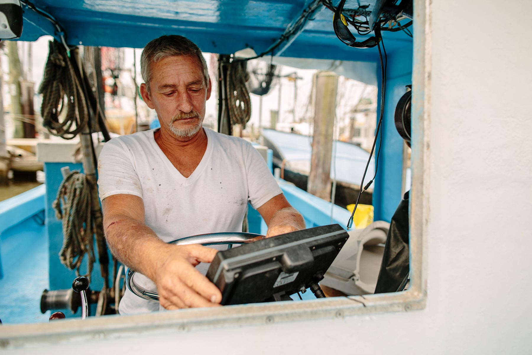
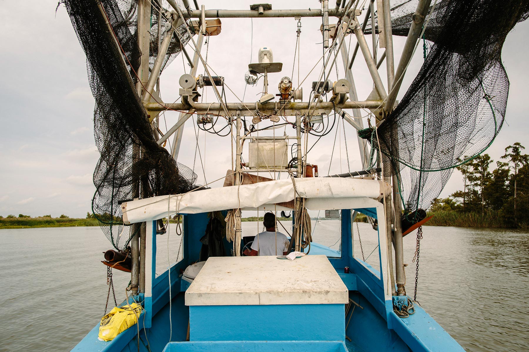
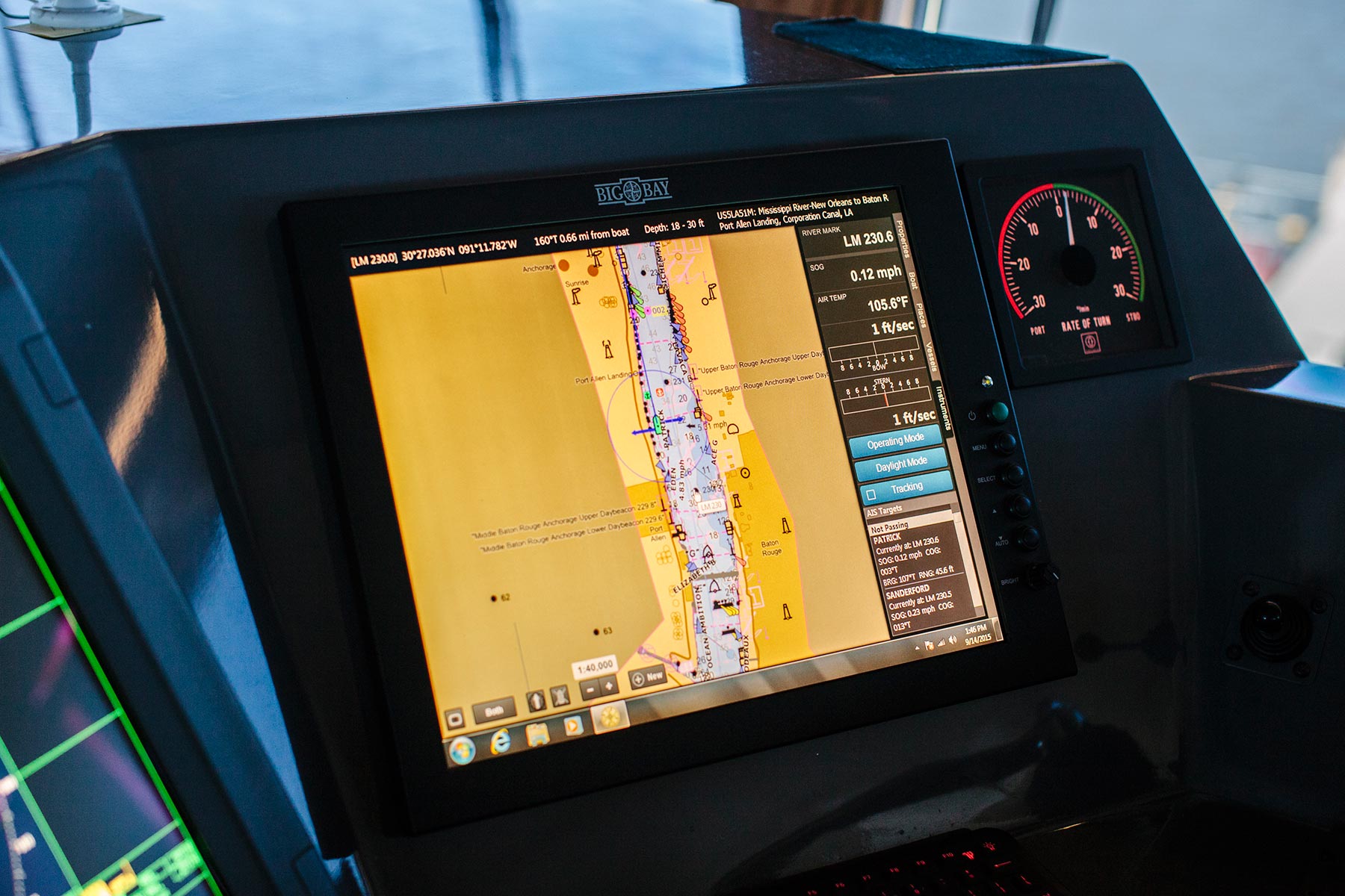
If you drive down the Mississippi River to the very end of the road, you reach the unincorporated community of Venice. Oil and gas towers rise above the fishing and shrimping marina, where Acey Cooper, 55, an animated Cajun shrimper, chugs away from the dock. His boat was built in 1983, and it still has the original 1983 electronic map on the console.
“Look at this,” he says, pointing out the digital tracks of last night’s shrimping voyage. “Everywhere I went in my boat is marked as solid ground on my map,” he says. “All this used to be forest. I used to hunt deer out here. Now we’ve got one ridge of trees left in Venice and some mud flats and the rest is open water. It’s going quick, and if we go, New Orleans is next.”
There are many good reasons to battle for Louisiana’s coastal wetlands. They are a national treasure for birds and wildlife. They generate about a billion dollars in annual tax revenue from the oil and gas industry, and contain $150 billion worth of infrastructure. Seafood thrives here, along with a rich, distinctive American culture. As Cooper points out, the coastal wetlands also function as a vital hurricane barrier for New Orleans, slowing down and diminishing the storm surges of water. Ten years ago Hurricane Katrina made landfall right here in Plaquemines Parish. It was a Category 3 hurricane on a scale of 5. If the wetlands southeast of the city hadn’t been so eroded and carved apart by canals and shipping channels, Katrina would have done far less damage.
Cooper worries that his 10 grandsons will be senile by the time all the studies are completed. “I know where the sediment is,” he says, lighting a cigar and shouting over the wind and engine noise. “I can show them where it’s at. We’ve got shit-tons of sediment just laying around doing nothing while they study this and study that. They should have 10 dredges out there building land around the clock.”

Like Ricks, Cooper is dead set against river diversions. The freshwater threatens his shrimp, he says, and he doesn’t see the river building any solid ground. “We’ve got the Mississippi right here. It’s loaded with sediment, but it ain’t building no land, just shoals and shallow water. But if they started dredging and pumping that sediment, you’d have an unbelievable amount of land in a few years.”
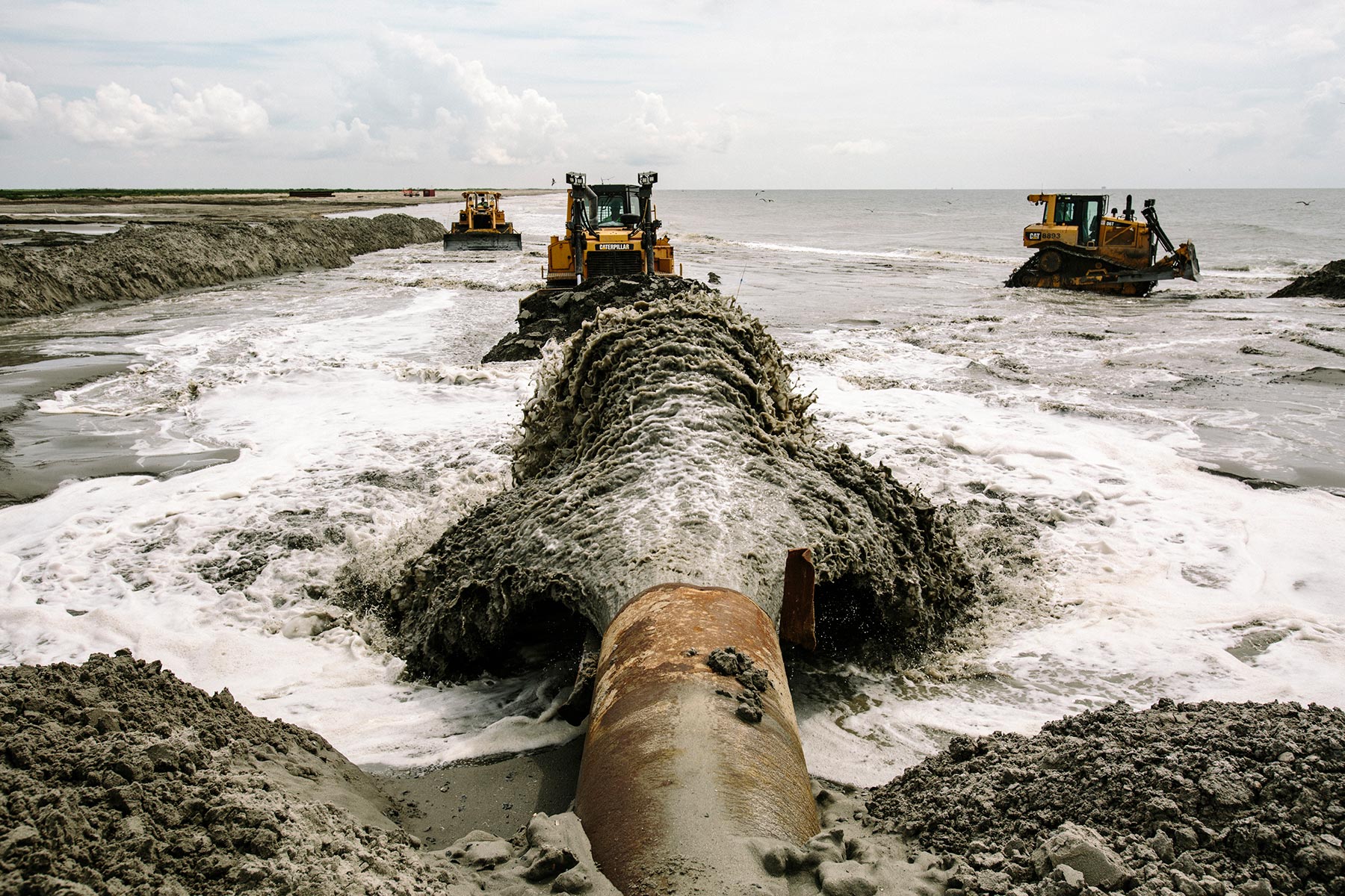
Instead, a different sort of dredging is taking place at the mouth of the Mississippi. This is America’s busiest shipping channel, and the U.S. Army Corps of Engineers is charged with keeping it open and navigable. In other parts of the Louisiana coast, the Corps is starting to use dredged sediment in beneficial land-building projects, but like the great ships approaching the Mississippi waterway, the agency has been slow to change direction.
Traditionally, it has regarded sediment as an obstacle and a nuisance, to be got rid of as quickly and cheaply as possible. So in eyeshot of the most sediment-starved place in America, its mighty dredge boats are sucking up 22 million cubic yards of sand and silt every year, taking it out into deep water and dumping it off the continental shelf, where it sinks irretrievably to the ocean floor.